
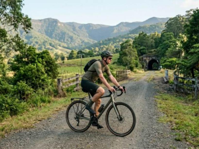

The Northern Rivers is the far north-east corner of New South Wales, running from the Queensland border down to the Clarence Valley. It covers about 20,700 km², and about 313,000 people live there (Wikipedia, 2022). Byron Bay gets the attention, but many of the best things to do in the Northern Rivers, NSW are inland.
Key takeaways
- Two sections of the Northern Rivers Rail Trail are open: Murwillumbah to Crabbes Creek (24 km) and Casino to Lismore (29.7 km).
- The Wollumbin (Mt Warning) summit track is closed until further notice.
- Cape Byron's official long-term rainfall is 1,735.7 mm a year, and many weather sites show much less.
- March is the wettest month on average, and September the driest.
What are the best things to do in the Northern Rivers NSW?
Most itineraries start at the beach and add a day trip inland. I'd flip that. The beaches in Byron Bay are easy to find. The rail trail, the rainforest and the river towns are the parts people miss.
Ride the Northern Rivers Rail Trail
The rail trail follows the old Casino to Murwillumbah railway line. When it's finished, it will be 132 km long (Northern Rivers Rail Trail, 2026). For now, you get two sections, with a 74 km gap between them.
The northern section runs 24 km from Murwillumbah to Crabbes Creek and opened in March 2023 (Bicycle Network, 2026). It goes through the Tweed Valley, past villages like Stokers Siding, Burringbar and Mooball, and through two tunnels.
The southern section runs 29.7 km from Casino to Lismore and has been fully connected since December 2024. It goes through the Naughtons Gap Tunnel. The surface is gravel, so leave the road bike at home (Rail Trails Australia).
So which one? Take a family driving down from Brisbane for a weekend (a hypothetical example). The Murwillumbah section is the easier choice. It's shorter, it's closer to the border, and the town has the Tweed Regional Gallery. A rider who wants a longer, quieter day through farmland would be happier on the Casino to Lismore section. For more short-break ideas, see our weekend trips.
Walk in the rainforest
Nightcap National Park, in the hills near Lismore, has Protesters Falls and the Terania Creek picnic area. The rain that keeps it green can also shut it. Both were closed for several days after heavy rain in May 2026 (Visit Lismore, 2026). Check the NSW National Parks alerts before you drive out, not after.
Stand on mainland Australia's most easterly point
Cape Byron is the most easterly point of the Australian mainland, and the lighthouse there is the region's best-known view. If I only had time for one stop in Byron Bay, this would be it.
Spend time in the river towns
South Murwillumbah is home to the Tweed Regional Gallery and Margaret Olley Art Centre (Rail Trails Australia). Down south, Yamba and Iluka are holiday towns at the mouth of the Clarence River. They're worth the drive if you want a beach base away from Byron.
Which towns are in the Northern Rivers NSW?
It depends on who you ask. The NSW Government counts seven council areas: Tweed, Byron, Ballina, Lismore, Richmond Valley, Kyogle and Clarence Valley (NSW Reconstruction Authority, 2026). The Northern Rivers Joint Organisation represents only six councils and leaves out Clarence Valley. So Grafton and Yamba are sometimes counted in the region and sometimes not.
Grouped by type, the main towns are:
- Coast: Tweed Heads (next door to Coolangatta, across the border), Brunswick Heads, Byron Bay and Ballina, plus Yamba and Iluka in the south
- Hinterland: Mullumbimby, Bangalow, Alstonville and Nimbin
- Inland: Lismore, a university town, plus the farming towns of Casino, Kyogle and Murwillumbah
- Clarence Valley: Grafton and Maclean, where Clarence Valley Council is based
Where you stay changes how you'll spend your days. A Byron Bay base puts you on the beach but means driving inland for the rail trail and national parks. A Murwillumbah or Lismore base flips that. You'll drive to the beach, but you'll be close to everything else.
What are the main rivers in northern NSW?
There are four: the Tweed, the Brunswick, the Richmond and the Clarence. Each has its own catchment and floods in its own way (NSW Government, 2026). The region's name comes from the three biggest: the Tweed, the Richmond and the Clarence.
The Clarence is the largest coastal river system in NSW. It's about 400 km long, and its catchment covers more than 22,000 km². Tributaries like the Mann and Orara rivers join it before it spreads onto the floodplain around Grafton, where levees protect the city.
These rivers make the valleys fertile, and they also flood. The February–March 2022 floods were so severe that the federal government funded an $11.4 million study into what caused them (CSIRO, 2022). If you're staying near a river in late summer or autumn, check BOM flood warnings before you leave home.
What is the weather like in the Northern Rivers of NSW?
Subtropical. Summers are warm and humid, winters are mild, and it rains all year. The best long-term official record for the coast comes from the Cape Byron Lighthouse weather station.
| January | July | |
|---|---|---|
| Average maximum | 27.5 °C | 19.3 °C |
| Average minimum | 20.8 °C | 11.7 °C |
Rain is the bigger story. Cape Byron averaged 1,735.7 mm a year from 1950 to 2012. March was the wettest month (202.9 mm) and September the driest (65.9 mm). There were about 121 days a year with at least 1 mm of rain. That's about one day in three (121 ÷ 365 ≈ 0.33).
Look up "Byron Bay rainfall" and you'll find figures from 1,157 mm to 1,510 mm. The official figure is higher than all of them. The lowest is 578.7 mm under the BOM figure (1,735.7 − 1,157), which is about a third of a year's rain. One site even labels its "Lismore" data as coming from Byron Bay, 36 km away.
Heat on the coast rarely gets extreme. Cape Byron averaged about 11 days a year over 30 °C, and none over 35 °C in the record. One caveat: the station closed in 2012, so these are long-term averages, not recent years. For the week you're travelling, check the BOM forecast instead.
When is the best time to visit?
If you want to stay dry, go from late August to November, the driest part of the year on average.
Every season has a trade-off. Summer is best for the beach, but it's also storm season and school holidays. Autumn stays warm, but March to May are the wettest months. Winter on the coast is mild, with average July maximums around 19 °C, and it's quieter.
One thing catches out summer visitors. NSW has daylight saving and Queensland doesn't, so from October to April, Tweed Heads is an hour ahead of Coolangatta next door. If you're flying in or out of Gold Coast Airport, check which time zone your booking uses.
What's closed or changed for visitors
The biggest change is Wollumbin. The summit track is closed until further notice (NSW National Parks, 2026) and has been closed to climbers since 2020. Wollumbin is sacred to the Bundjalung people, and under Bundjalung law only certain people may climb it.
The mountain isn't completely off-limits. The Lyrebird walking track and the visitor facilities at Breakfast Creek are still open.
The rail trail also isn't joined up yet. Funding is still being sought for 62.8 km through Byron Shire, from Yelgun to Eltham, and for 20.9 km from Lismore to Booyong (Lismore City Council, 2026). You can't ride from Byron Bay to Lismore on it yet.
With kids, the flat, car-free sections of the rail trail are one of the easiest days out in the region. See our family holiday ideas for more.
FAQ
Is Grafton part of the Northern Rivers?
The NSW Government says yes, because it counts Clarence Valley as part of the region. The Northern Rivers Joint Organisation covers only six councils and leaves Clarence Valley out.
What is the largest river in northern NSW?
The Clarence. It's the largest coastal river system in NSW, about 400 km long, with a catchment of more than 22,000 km².
What are the best things to do in the Northern Rivers NSW on a rainy day?
Visit the Tweed Regional Gallery and Margaret Olley Art Centre in South Murwillumbah. Skip the national park tracks after heavy rain, because they can close with little warning.
Is the Northern Rivers Rail Trail finished?
No. About 54 km of the planned 132 km is open (24 + 29.7 = 53.7 km), split between Murwillumbah to Crabbes Creek in the north and Casino to Lismore in the south.
Byron Bay is the famous part of the Northern Rivers, but it isn't the whole story. The inland towns and river valleys are quieter, and they're where you'll see the region's best things to do.
Don't try to see everything in one weekend. The region is spread out, so pick one area and give it time. For general planning, see our travel tips.
Before you leave, check the BOM forecast and the NSW National Parks alerts for each place on your list.